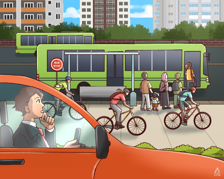
Picture two Saturday mornings, in two similar HDB flats, priced almost identically.
In the first, a young couple straps their toddler into a car seat, fights for a parking lot at the mall, and spends the afternoon shuttling between errands that are each a 15-minute drive apart. In the second, the family walks out of their lift lobby, crosses a sheltered footpath, passes a coffeeshop and a minimart, and reaches the MRT station in under eight minutes. The weekend is spent at the waterway, the park connector, and the hawker centre — no car keys required.
Increasingly, Singapore's home buyers are paying real money to be in the second scenario. The Republic's car-lite vision — a policy push that began as a vague aspiration about zebra crossings and cycling paths — has matured into a concrete force reshaping neighbourhood desirability, and with it, the HDB resale values that young families are transacting on every week. From Tampines, the veteran model town that proved walkable precincts could work at scale, to Punggol, which was born car-lite and is now debugging the prototype for the rest of Singapore, walkability has moved from lifestyle bonus to financial variable.
This article breaks down how the car-lite agenda is tilting the HDB resale market, which design features actually move the needle for buyers, and where the next walkable hotspots are likely to emerge.
The Car-Lite Vision: From Catchphrase to Concrete Policy
The phrase "car-lite Singapore" entered the national vocabulary in 2014, when the Government convened a committee to study how to reduce the Republic's reliance on private cars. It was an easy idea to caricature — a war on car owners led by urban planners who spent too much time in air-conditioned rooms. But the substance behind it was always more pragmatic than ideological.
A small, dense city-state simply cannot build enough roads for universal car ownership. Instead of fighting the inevitable gridlock, Singapore chose to make the alternatives so good that owning a car becomes a choice rather than a necessity. That strategy has three pillars:
- Public transport as the backbone — rail and bus networks that can carry the vast majority of peak-hour journeys.
- Active mobility as the middle layer — cycling paths, park connectors, and footpaths that stitch neighbourhoods together for short trips.
- Land use integration — putting homes, workplaces, schools, and daily amenities close enough to each other that many trips never need a motor vehicle at all.
By 2019, the Land Transport Master Plan 2040 (LTMP2040) gave this vision a memorable slogan: "Walk, Cycle, Ride." The headline goal is ambitious — nine in ten peak-period journeys should be completed by walking, cycling, or taking public transport by 2040.
Signals of this shift are now visible in everyday Singapore life. Car-Free Sunday SG, launched in the CBD and Civic District, closes parts of the city centre to vehicles periodically so pedestrians and cyclists can reclaim the streets. New towns like Tengah are being designed with car-free town centre zones and district-wide cycling networks. Older towns are retrofitting covered walkways, barrier-free crossings, and cycling loops.
The policy trajectory matters to anyone hunting for an HDB resale flat because it changes what a neighbourhood is worth. When the Government commits billions of dollars to rail lines, cycling paths, and town centre upgrades, the value does not spread evenly. It concentrates in the estates that are best positioned to benefit — and that is exactly where the resale premium is forming.
Why "Walkability" Shows Up in Home Prices
On paper, an MRT station benefits everyone within a town. In practice, the benefit decays quickly with distance. Estate agents and valuers have long described a pricing gradient around transport nodes: flats within a short, comfortable walk of a station command more per square foot than identical flats further away.
The same logic extends beyond the station itself. A car-lite neighbourhood is essentially a bundle of amenities placed within walkable reach. When HDB design puts a hawker centre, a supermarket, a clinic, a childcare centre, and a park all within a 10-minute walk of your block, you are not just buying a home — you are buying a lifestyle that may allow your household to avoid the cost of car ownership entirely.
And car ownership in Singapore is no longer a modest monthly line item. Between surging Certificate of Entitlement (COE) premiums — which have spent long stretches in six-figure territory in recent years — plus loan repayments, insurance, road tax, fuel or charging, ERP charges, parking, and maintenance, finance commentators have long estimated the true cost of running a mass-market car at well over S$1,500 a month when depreciation is included. Over a typical loan tenure, that is hundreds of thousands of dollars.
A household that can comfortably live car-lite has effectively unlocked an enormous amount of housing budget. So it is unsurprising that walkability has become a lens through which young buyers evaluate flats:
- Transport proximity cuts commute time, the single biggest determinant of daily satisfaction for most working professionals.
- Amenity clustering reduces the need for weekend car trips for groceries, medical visits, and children's activities.
- Green connectivity — park connectors and cycling paths — turns exercise from a gym appointment into an incidental part of daily life.
- Active mobility safety matters more to families with young children, who want routes to school that do not require crossing major roads.
- Future-proofing — as buyers age, the ability to access daily services without driving becomes a health and independence issue.
None of this means car-dependent estates are doomed. But it does mean that when buyers compare two flats at similar prices, the walkable one has an extra layer of demand beneath it — and extra layers of demand are what support resale values when the market cools.
Tampines: The Mature Model of Walk-and-Ride Urbanism
Tampines is Singapore's great car-lite success story, and it is worth understanding because it shows what decades of consistent planning looks like.
Developed from the 1980s as one of the first new towns to break from the old dormitory-town model, Tampines was built around a central town centre rather than a scatter of isolated precincts. That single decision created the skeleton for walkability: a dense core where retail, services, and transport meet, surrounded by residential precincts close enough to reach it comfortably on foot.
Today, Tampines offers a textbook case of how infrastructure layers compound over time:
- Rail connectivity: The East West Line arrived in 1989 with Tampines station. In 2017, the Downtown Line added Tampines West and Tampines East stations, effectively turning Tampines into a two-line town. The Tampines interchange is now one of the busiest nodes in the eastern corridor.
- Integrated community hub: Our Tampines Hub, opened in the late 2010s, clusters a regional library, sports facilities, a hawker centre, and community services around the town centre. For residents in the surrounding blocks, "run an errand" means a walk under shelter, not a drive to another building.
- Cycling infrastructure: Tampines was among the first towns selected for LTA's cycling path programme, giving it an early lead in the kind of active-mobility infrastructure newer towns are now designing from scratch.
- Connector networks: The town links into the wider Park Connector Network, with green corridors that let cyclists and joggers move between Tampines and the coast without sharing a road with cars.
The property takeaway is visible in how the resale market treats Tampines Central. Flats near the interchange and the Hub tend to enjoy both high transaction volumes and pricing resilience — they are among the first to sell when the market softens and among the first to move upward when it strengthens.
| Car-Lite Feature | How It Shows Up in Tampines | Resale Market Relevance |
|---|---|---|
| Two MRT lines | East West Line + Downtown Line interchange | Widens the pool of buyers who can commute car-free |
| Integrated town centre | Our Tampines Hub anchored by retail, sports, library | Shortens errand trips; boosts appeal to families |
| Cycling town network | Early LTA cycling paths within the town | Attracts active-mobility households |
| Park connectors | Green links to the eastern park network | Adds lifestyle value beyond the flat itself |
| Bus interchange | Adjacent to the interchange and retail core | Last-mile redundancy for non-drivers |
Tampines also matters because it disproves a lazy stereotype that car-lite living is only for young, central, or trendy towns. This is a mature estate with a significant population of seniors and families, yet its design has aged gracefully precisely because the walkable core was built from the start. For resale buyers, buying into Tampines is a bet that the town's central infrastructure will keep supporting demand for decades — a safer bet than relying on any single amenity.
Punggol: The Town Designed Without the Car as the Main Character
If Tampines represents the retrofit of car-lite thinking, Punggol represents the clean-slate version. When Punggol 21 was unveiled in the 1990s, the brief was to build a waterfront town for the 21st century. What emerged went further: an eco-town where sustainability and walkability were woven into the master plan rather than added later.
Punggol's geography gave it an unusual gift. The man-made waterway winding through the town connects two reservoirs and creates a 4.2-kilometre blue-green spine that organises the entire community. This is not just aesthetic. The waterway, lined with promenades and cycling tracks, functions as a car-free corridor connecting residential precincts, parks, and town facilities.
The town's transport story is instructive for anyone tracking resale values:
- The North East Line has served Punggol since 2003, and the LRT system fans out from the station to reach residential precincts.
- Punggol Coast MRT station opened in December 2024 on the North East Line extension — the line's first new station since its opening — bringing rail directly to the emerging Punggol Digital District and the surrounding north-eastern precincts.
- New residents moving into BTO and resale flats today are buying into a town whose connectivity improves in waves, which helps explain steady demand even when the broader market is cautious.
Punggol also points to where car-lite urbanism is heading next. The Punggol Digital District — Singapore's first enterprise district to combine business, academia, and research — is being billed as a car-lite smart district, with a central agora-style street where pedestrians and cyclists take priority over vehicles. When a new town can offer tech jobs, a university campus, and rail access within walking distance of homes, you have the classic conditions for a self-reinforcing property market.
| Attribute | Tampines | Punggol |
|---|---|---|
| Generation of town | 1980s model town | Post-2000 eco-town |
| Rail network | East West Line + Downtown Line | North East Line + LRT + Punggol Coast |
| Signature feature | Regional hub with integrated community centre | Waterway park spine |
| Cycling infrastructure | Early cycling town retrofit | Built-in tracks along waterway and connectors |
| Employment proximity | Regional commercial centre | Punggol Digital District (emerging) |
| Maturity of resale market | Deep, highly liquid | Younger, more BTO-driven but growing |
For the resale buyer, the difference between Tampines and Punggol is a choice between proven liquidity and growth optionality. Tampines has a deep stock of flats with clear pricing benchmarks. Punggol offers the chance to buy into a town whose infrastructure story is still being written — with the Punggol Digital District and future transit improvements potentially lifting demand over the longer term.
Reading the Resale Data: Where the Car-Lite Premium Actually Shows Up
If walkability is so important, how does it show up in actual HDB resale transactions? The honest answer is that it rarely appears as a single line item. Instead, the premium is embedded in several observable patterns that anyone can look for in transaction data:
- Distance gradients around stations: In most towns, resale prices ease as distance from the rail station increases, even after accounting for block age and floor level. The sharpest drop is often within the first 400 to 800 metres — the threshold most people are willing to walk comfortably.
- Premium for shelter and path quality: Two blocks may be the same distance from a station, but the one connected by a covered walkway tends to behave differently in the market. Rain is a great equaliser in Singapore, and sheltered connectivity is a form of convenience that buyers learn to value.
- Amenity adjacency: Blocks near a town centre with a hawker centre and supermarket often sustain higher prices than equivalent blocks near a quieter but emptier precinct. The "silent" advantage of being able to walk for dinner is visible in transaction volumes.
- Transaction velocity: In hot markets, everything sells. In cooler markets, walkable flats sell first. Car-lite estates often demonstrate shorter selling times because they appeal to a wider demographic — young couples, older upgraders, and investors who know the rental appeal of transit-adjacent homes.
One caveat matters here: correlation is not causation. A town with strong MRT access often also has newer flats, better common areas, and higher original construction standards. The walkability premium is real, but it rarely operates in isolation — it compounds with other factors such as remaining lease, floor level, and the reputation of the local schools. This is one of the reasons the resale market rewards careful, systematic comparison rather than vibes alone.
There is also a structural limit to the car-lite premium. Flats that are walkable to a station but located in a precinct with weak amenities, poor maintenance, or a shortening lease will not be rescued by proximity alone. Conversely, a mediocre location with outstanding walkable design can punch above its weight. The market is effectively paying for the combination of transport, amenity, and urban quality — which is exactly what car-lite planning bundles together.
Young Families Are Voting with Their Sandals
The demographic pressure behind the walkability premium is impossible to ignore. Singapore's young families — the core buyers of HDB resale flats — are making home-buying decisions in a very different economic environment from their parents.
Consider the arithmetic of young parenthood. A household with one or two children faces school runs, enrichment classes, weekend sports, and the endless logistics of feeding and clothing a growing family. In a car-dependent suburb, every one of those tasks adds a trip. In a walkable town, many of them collapse into a single loop: walk to school, walk to the hawker centre for lunch, walk home through the park.
This is why estate agents report that families increasingly filter their searches around specific routes — not just around MRT stations, but around the path from the block to the childcare centre, and from the childcare centre to the grandparents' flat. When both parents work, the ability to delegate school pickups to grandparents who cannot drive becomes a financial and logistical lifeline, and that favour tends to show up in the prices families are willing to offer for the right block.
Several factors are accelerating this shift:
- The cost of car ownership is no longer abstract. COE premiums have made even entry-level cars a luxury purchase, pushing younger households to question whether car-lite living is a lifestyle choice or a financial necessity.
- Hybrid and remote work have weakened the "I must drive to work" argument. Many young professionals now need the MRT a few days a week, not five — but they still want those few days to be painless.
- The bank of mum and dad is more location-aware. Parents helping their children with down payments often push toward towns where they themselves can visit easily by public transport.
- Health and environmental values are mainstream. For buyers under 40, living somewhere you can cycle to brunch is not a niche interest; it is a quality-of-life checkbox.
The generational shift has a subtle effect on the HDB resale market. When a demographic cohort stops treating car ownership as a non-negotiable adult milestone, the estates that accommodated cars first — wide roads, big carparks, dispersed amenities — lose some of their shine. Estates that designed for people first gain it.
The Next Car-Lite Hotspots to Watch
The car-lite premium is not static. Every new MRT line, every new cycling trunk route, and every new integrated development rewrites the walkability map — and savvy buyers try to stay ahead of the curve. A few areas stand out as the next frontiers.
Tengah is the most obvious candidate. Singapore's first "smart" HDB town, Tengah is being built with a car-lite ethos baked into its DNA: a town centre where vehicles are routed around and beneath the pedestrian level, extensive cycling paths, and district-level green spaces connecting residential clusters. When the Jurong Region Line arrives later in the decade, Tengah's walkable town centre will plug directly into the wider rail network. For resale buyers, the BTO queue there is long for good reason — those who miss out will increasingly shop for resale flats in the vicinity as the town matures.
Jurong Lake District is a larger but slower-burning story. As the planned "second CBD," it is being positioned as a car-lite business district with the Jurong Region Line, Cross Island Line, and cycling networks tying together residences, offices, and the lakeside gardens. HDB flats in the surrounding towns — Jurong East, Jurong West, and nearby — stand to benefit from an infrastructure build-out that is already underway.
The rail expansion map itself is a hotspot detector. When the Cross Island Line stages open through the 2030s, swathes of central and eastern Singapore that were previously dependent on buses will gain rail access, and the walkability catchments around new stations will be redrawn. The Thomson-East Coast Line has already done this for parts of the east coast, and each new line opening has historically triggered a repricing of nearby homes as buyers anticipate the convenience gain.
The general principle for spotting the next car-lite hotspot is simple: look for places where a major piece of infrastructure is already funded and under construction, then evaluate the blocks that will fall within its walkable catchment. The premium tends to be most affordable before the infrastructure opens, because the market prices the uncertainty heavily at first and only reassesses once the project becomes tangible.
Food for Thought
As you weigh your own flat-hunting criteria, consider these questions:
-
Which matters more — proximity to a station, or proximity to where you actually go? A flat 500 metres from an MRT station is valuable only if the train takes you somewhere useful. Car-lite value depends on the full journey, not just the first leg.
-
Would you pay more for a flat in a town with a future infrastructure plan? Buying ahead of a new line opening can mean waiting years for the premium to materialise. How long are you willing to hold, and can the rental market carry the flat in the meantime?
-
How do you weigh lease decay against walkability? Some of Singapore's most walkable towns are also its oldest. A mature town like Tampines offers superb convenience, but its early flats have shorter remaining leases. How much convenience premium justifies lease depreciation?
-
Is the car-lite premium a family-stage or a lifetime factor? The household that needs no car today may want one when children grow older or parents age. Will the estate still serve you — or can you adapt by moving to a different block within the same walkable catchment?
-
What does "walkable" really mean in a tropical climate? A 10-minute distance in pleasant weather is different from a 10-minute distance under the afternoon sun. Covered walkways, trees, and sheltered links are not minor details — they determine whether the walk is actually taken.
These are precisely the trade-offs that transaction data can illuminate, particularly when you compare blocks within the same town that differ mainly in their walkability profile.