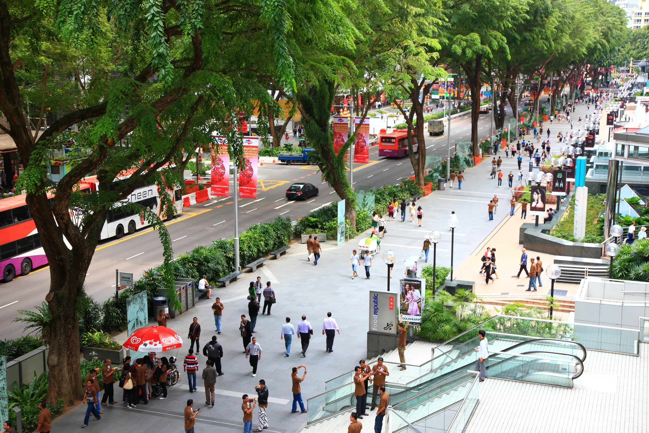
A widely cited global study of pedestrian speeds across 32 cities once clocked Singaporeans as the world's fastest walkers — zipping along at about 1.7 metres per second. Anyone who has crossed a junction at Raffles Place during lunch hour knows this is true. But here's the irony: Singaporeans may walk fast, yet most of us still design our lives around the MRT map, the bus network, and — if we're not careful — a monthly car payment that could fund a small holiday.
When we talk about the most walkable neighbourhoods in Singapore, we're really talking about the quietest financial decision a young adult can make: living somewhere that makes car ownership feel optional. With Certificate of Entitlement (COE) prices swinging past S$100,000 and the Government doubling down on its car-lite vision, the "walkable address" has become one of the most valuable features a home can have. This article ranks the HDB towns and condo districts that let you live well without a car — looking at footpaths, sheltered routes, nearby amenities, and MRT connectivity to find the addresses with the highest walkability.
Why "Walkability" Suddenly Matters in Singapore Property
For decades, the Singaporean property dream was straightforward: bigger flat, better view, nearer to town. Walkability rarely made the list. Then the Land Transport Master Plan 2040 arrived with two memorable promises — "20-Minute Towns" and "45-Minute City." The idea is that every resident should reach their daily needs within 20 minutes on foot, by bike, or by public transport, and the city centre within 45 minutes. That single policy shift quietly changed how property buyers evaluate a home.
The financial arithmetic makes the case even more forcefully. According to industry estimates, owning a car in Singapore — COE amortised, plus insurance, petrol, parking, ERP and maintenance — typically costs S$1,800 to S$2,500 per month. A monthly public transport pass, by contrast, costs around S$128. Even a heavy ride-hailing user will struggle to spend that much on daily commutes.
Indicative Monthly Cost of Getting Around (S$)
The chart above is deliberately rough — actual car costs depend on model, loan structure, and how many kilometres you clock. But the order of magnitude is the point. Choosing a walkable neighbourhood is not a lifestyle compromise; it is effectively a S$20,000-to-S$25,000-a-year decision disguised as a property decision.
There is also a documented price effect. Academic research on Singapore's resale market has repeatedly found a measurable "MRT premium" — flats within walking distance of a station trade at a premium over comparable flats further out, and prices and rents tend to move measurably when a new station opens nearby. Walkable neighbourhoods, in other words, are not just cheaper to live in day-to-day. They also tend to hold their value better.
What Really Makes a Neighbourhood Walkable in Singapore
Walkability in Singapore is not the same as walkability in Copenhagen or Tokyo. The tropical climate rewrites the rules. A 600-metre stroll to the station is pleasant at 7am and punishing at 1pm in 32°C heat with 80% humidity. Rain arrives without warning. So a genuinely walkable Singapore neighbourhood is not merely close to things — it is engineered to make walking tolerable.
Here are the factors that actually matter:
- MRT proximity: The official benchmark is a 10-minute walk — roughly 500 to 600 metres. LTA has committed to 8 in 10 households living within a 10-minute walk of a train station by 2030.
- Sheltered walkways: Covered walkways, link bridges, and sheltered bus stops turn a walk from a gamble with the weather into a reliable daily routine. LTA announced plans to add 200 km of sheltered walkways — on top of the existing network — with much of it delivered by 2026.
- Amenity density: Hawker centres, coffee shops, supermarkets, clinics, schools, and gyms within a 10-minute walk. This is the difference between "near the MRT" and "can actually live without a car."
- Green and shaded routes: Park connectors — now more than 300 km and growing — plus tree-lined streets that keep the afternoon sun off your neck.
- Safety and crossings: Pedestrian-friendly junctions, slower traffic, and well-lit paths. Nobody walks at night if the route feels sketchy.
- Flat terrain: Obvious but overlooked. A 700-metre walk on flat ground feels far shorter than 400 metres up a slope.
The MRT network itself is the backbone of all of this. Singapore's rail network has grown from 6 km in 1987 to roughly 230 km today, with a target of about 360 km by the early 2030s — which is why more and more HDB towns are becoming naturally walkable.
MRT Network Length in Singapore (km, approximate)
As the chart shows, every decade has added major chunks of rail — and every chunk turns a new batch of neighbourhoods from car-dependent into car-optional.
The way to think about a walkable neighbourhood is as a layered system. The MRT gets you across the island; feeder buses fill the gaps; sheltered walkways and park connectors handle the last mile; and local amenities make sure the first mile — from your front door to the station — is never wasted.
When all the layers work, you get a town like Tiong Bahru or Bishan, where residents genuinely forget they own a car — or never bother buying one in the first place.
The Most Walkable HDB Towns in Singapore, Ranked
HDB towns are the natural starting point for a walkability ranking because they were planned with density and public transport in mind. To compare them fairly, this article uses a transparent editorial rubric with five criteria, each scored out of 10, for a maximum of 50 points:
- MRT connectivity — number of lines and stations, plus interchange convenience.
- Shelter coverage — how much of the walk to the station is covered.
- Amenity density — hawker centres, malls, supermarkets, clinics, and schools within walking distance.
- Green space and walking comfort — park connectors, parks, and shade.
- Everyday car-free feasibility — can you realistically run your entire weekly life without a vehicle?
This is an editorial exercise, not Hiva's proprietary scoring — but every criterion can be verified with a map, a pair of walking shoes, and a rainy Tuesday afternoon.
Editorial Walkability Score by HDB Town (out of 50)
Here is the full breakdown:
| Town | Score (/50) | MRT lines | Signature walk | Verdict |
|---|---|---|---|---|
| Tiong Bahru | 46 | East West Line | Tiong Bahru Market → Seng Poh Road → conserved pre-war flats | Walkable heritage, unbeatable charm |
| Queenstown | 44 | East West Line | Queensway → Dawson estate → Margaret Drive | Singapore's original planned walkable town |
| Bishan | 43 | North South + Circle Line | Junction 8 → Bishan-Ang Mo Kio Park | Best balance of mall, park, and interchange |
| Toa Payoh | 42 | North South Line | HDB Hub → SAFRA → Toa Payoh Park | Mature central town with everything |
| Punggol | 41 | North East Line + LRT | Waterway Point → Punggol Waterway | Waterfront walks, cycling-first design |
| Serangoon | 40 | North East + Circle Line | nex mall → Upper Serangoon Road | Underrated suburban hub |
| Ang Mo Kio | 39 | North South Line | AMK Hub → Bishan Park connector | Old-school walkability |
| Tampines | 38 | East West + Downtown Line | One Tampines Hub → Tampines Eco Park | Regional centre with big-box coverage |
| Jurong East | 37 | East West + North South (+ future JRL) | JEM/Westgate → Jurong Lake Gardens | High density, watch the heat |
| Woodlands | 35 | North South + Thomson-East Coast Line | Causeway Point → Woodlands Waterfront | Improving fast, still shelter-inconsistent |
Tiong Bahru: The Gold Standard of Car-Free Living
Tiong Bahru tops the ranking because it is walkability and character rolled into one. The neighbourhood's pre-war walk-up flats — built by the Singapore Improvement Trust in the 1930s — sit on low-rise streets designed before the car became king. The result is a human-scaled grid where everything you need is centimetres away.
The Tiong Bahru Market and Food Centre alone justifies the score. It is one of Singapore's most famous hawker centres, and it is a two-minute walk from the MRT station for much of the estate. Coffee shops line Seng Poh Road. The new-ish integrated development at Tiong Bahru Plaza puts a supermarket, clinic, and food options right next to the station. For greenery, the estate borders the Singapore River park connector and is a short walk from the Great World City area.
The trade-off: flats here are older and pricier than equivalent floor areas in newer towns. Resale prices in the Tiong Bahru area historically command a premium over neighbouring districts — that is the walkability premium doing its thing. For a young couple or small family, though, few addresses in Singapore offer as much daily life on foot.
Queenstown: Where Singapore's Walkable DNA Began
Queenstown is Singapore's first satellite town, developed from the 1950s, and it is still a masterclass in walkable planning. The original planners put the train station (first in the town, on the East West Line), the town centre, the cinema, and the market within a compact walking radius. Modern upgrades — especially around the Dawson estate — have doubled down on that DNA with sheltered walkways, community plazas, and design award-winning public housing.
The walking routes here are genuinely pleasant: from the Dawson blocks down to Margaret Drive, past the new Queensway shopping stretch, and on to the Alexandra Canal Linear Park. Anchorage, the old Margaret Drive school sites, and the redeveloped Queenstown MRT area all feed into a connected pedestrian network. There are also several healthcare facilities — Alexandra Hospital is walking distance for some residents — which quietly makes the estate age-friendly. If "walk to work, walk to dinner, walk to the park" is the brief, Queenstown delivers.
Bishan: The Interchange Advantage
Bishan's secret is the North South and Circle Line interchange. Two MRT lines mean two directions of escape — a walkable town that also makes the rest of Singapore walkable to you. Junction 8, the long-running mall that anchors the town, sits directly above the station, while Bishan Bus Interchange next door covers the last-mile gaps.
What elevates Bishan above other interchange towns, though, is Bishan-Ang Mo Kio Park. One of Singapore's largest green spaces, it runs along the Kallang River and is connected to a park connector network that reaches the city centre. Rain or shine, the route from the HDB blocks to the station is almost fully sheltered. The HDB estate itself is mature — meaning clinics, coffee shops, schools, and sports facilities are woven into the blocks rather than concentrated in a mall. For families who want car-free childhoods, Bishan is hard to beat.
Toa Payoh: The Mature Central All-Rounder
Toa Payoh was one of the first HDB towns, and five decades of maturation have made it extraordinarily convenient. The town centre — HDB Hub, SAFRA, Toa Payoh Library, the bus interchange, and the MRT station — forms a single connected pedestrian pod. Schools are walkable. Toa Payoh Park offers greenery. And the location is so central that almost anywhere in Singapore is an MRT ride away without a transfer for most destinations.
The one knock against Toa Payoh is that some of its older blocks are farther from the station than Tiong Bahru or Bishan equivalents, and the shelter coverage thins out the further you get from the town centre. Still, for a "everything is here" lifestyle, Toa Payoh remains a top-tier car-free address, and its resale flats attract steady demand for exactly that reason.
Punggol: The Waterfront Upstart
Punggol is the youngster on this list — and the most ambitious. The town was planned from the start as a walking and cycling environment, with the Punggol LRT loop (16 stations) feeding the North East Line, and a network of cycling paths and park connectors that now rivals any town in Singapore. Waterway Point, the integrated development above Punggol MRT, anchors the town centre with a mall, supermarket, and bus interchange all in one climate-controlled block.
The signature experience is the walk along the Punggol Waterway — an actual waterfront promenade running through the heart of the estate, dotted with cafes, playgrounds, and exercise corners. Coney Island Park is a short bike or bus hop away. The trade-off is distance: Punggol is far from the city centre, so car-free living here depends heavily on the North East Line. But for those who work in the north-east or the city, the daily walk to the station is among the most pleasant in Singapore.
Honourable Mentions
- Serangoon: The NEL/CCL interchange plus nex mall makes it a sleeper hit — arguably the most walkable town that never makes these lists.
- Ang Mo Kio: Old-school, flat, and dense, with AMK Hub and the park connector to Bishan. The sheltered walkway network is patchy but improving.
- Tampines: A regional centre with One Tampines Hub and two MRT lines — huge amenity density, though the town layout is more spread out than the central towns.
- Jurong East: The malls of JEM, Westgate, and IMM create an air-conditioned walkable core, and Jurong Lake Gardens is stunning after its redevelopment. But the open plazas can be punishing at noon, and the estate housing is a slightly longer walk from the interchange.
Best Condo Districts to Live Without a Car in Singapore
HDB towns are the obvious walkability champions, but condo dwellers have their own version of car-free living. Private condos in walkable districts tend to be smaller or older than equivalent suburban units, yet they offer something a car cannot: the ability to step out the door and be in the middle of life.
For condo buyers, a key insight is that integrated developments — condo blocks attached to malls and MRT stations — function like vertical walkable towns. Developments such as those above or beside major hubs effectively put the entire town centre downstairs. But if you prefer a traditional condo in a walkable street grid, these districts stand out:
| District | MRT access | Walkability highlights | Best for |
|---|---|---|---|
| D15 (Katong/Joo Chiat/Marine Parade) | Thomson-East Coast Line (Marine Parade, Katong Park) | Shophouse streets, East Coast Road food trail, park connector to East Coast Park | Food lovers, families, culture seekers |
| D19 (Serangoon) | NEL + CCL interchange | nex mall, Upper Serangoon Road, walkable HDB/condo mix | Practical families who want value |
| D14 (Paya Lebar/Geylang) | EWL + CCL interchange | Paya Lebar Quarter, Geylang Serai Market, reclaimed walking boulevards | Young professionals, upgraders |
| D20 (Bishan/Ang Mo Kio) | NSL + CCL | Junction 8, Bishan Park, sheltered routes | Families who want space plus convenience |
| D5 (Pasir Panjang/West Coast) | CCL | Portsdown Road, Gillman Barracks, ABC Brickworks | Creative types, researchers, NUS staff |
| D16 (Bedok) | EWL | Bedok Town Centre, hawker cluster, coastal park connector | Budget-conscious HDB upgraders |
D15 deserves a special mention. Katong and Joo Chiat have some of the most walkable street fabric in Singapore — low-rise shophouses, narrow roads, and a concentration of cafes and restaurants that makes car ownership feel pointless. The opening of the Marine Parade and Katong Park MRT stations on the Thomson-East Coast Line in 2024 removed the last excuse for not living here: the area is now genuinely connected to the city without a car.
D14 is another underrated pick. The Paya Lebar quarter, rebuilt around the EWL/CCL interchange, was designed with wide pedestrian boulevards and sheltered walkways. Geylang Serai Market is a 10-minute stroll, and the food options along Upper Paya Lebar Road and Sims Avenue are legendary.
One caveat for condo dwellers: some of Singapore's most exclusive addresses are also its least walkable. Hillview (D23), for instance, is beautiful and forested, but the nearest station can be a sweaty slog, and the estates are spread along gentle slopes. Cluny Road, Bukit Timah, and parts of Sentosa Cove all score poorly on everyday walkability despite stratospheric prices. A big home in a car-dependent location quietly commits you to a S$2,000-a-month car habit.
The Walkability Premium: What Car-Free Locations Do to Prices
If walkable neighbourhoods are so great, why doesn't everyone live in one? Because walkability is a limited resource, and the market prices it accordingly. The trade-offs appear in every segment:
| Choice | Walkability | Price | Who it suits |
|---|---|---|---|
| Older HDB flat in Tiong Bahru/Queenstown | Very high | High per square foot, smaller floor area | Singles, couples, small families |
| Newer BTO in Punggol/Cakan | High, improving | Subsidised, larger flat, longer commute | First-timers who value space |
| Condo in D15/D19 | High | Moderate-to-high, older stock | Those who want condo amenities without a car |
| Big condo in D23/OCR | Low | High for size, car basically required | Car-owning families |
The pattern is consistent: buyers pay more per square foot for walkability, but they often get back savings on transport and future value. Research on resale flats near MRT stations has repeatedly found price premiums that are largest for the closest flats and shrink steadily with distance. The premium is not static — it tends to grow when a new line opens (expect a bump as the rest of the Thomson-East Coast Line and Jurong Region Line materialise) and can soften when the broader market cools, but the direction is clear.
There is also a rental angle. Walkable neighbourhoods benefit from steady rental demand because expatriates, young professionals, and students disproportionately choose car-free living. Post-pandemic, the shift toward hybrid work has made "walk to a decent lunch and a park" more valuable than "walk to the office." Districts like D15, D14, and D19 have been consistent outperformers on the rental front for this reason.
And one more thing to consider: future-proofing. Every new MRT line reverses the walkability equation of some neighbourhoods. The Home Team was recently alerted to the fact that the Jurong Region Line will transform the walkability of the entire Jurong area by the late 2020s — and prices around future stations have historically started moving years before trains arrive.
Food for Thought
- Would you trade 100 square feet for a 5-minute shorter walk to the station? Resale data suggests many buyers already do — but the trade-off feels different when you are the one living in the smaller flat.
- Does a condo's swimming pool and gym offset a poor walkable location? Condo facilities shrink your radius of needs — but they do not buy groceries or get you to work.
- Which upcoming MRT station will create the next walkability jackpot? The Thomson-East Coast Line phases, the Jurong Region Line, and the Cross Island Line will each flip several neighbourhoods from car-dependent to car-optional. Get there before the premium.
- Is "walkability" the same for a retiree as for a 30-year-old? Shelter coverage, benches, gentle slopes, and clinic access matter more with age — the most walkable town for you might not be the most walkable town for your parents.
- If the COE price dropped by half, would you still choose a walkable neighbourhood? The answer says a lot about whether walkability is a convenience or a value for you.
The Bottom Line
Walkable neighbourhoods in Singapore are not a niche lifestyle preference — they are a rational response to the city's cost structure. The COE market, the expanding MRT network, the sheltered walkway programme, and the Government's 20-minute town targets all point the same direction: the value of a home is increasingly defined by what is within walking distance of its front door.
Tiong Bahru charms, Queenstown impresses with its history, Bishan delivers the interchange uplift, and Punggol proves that newer towns can be planned for pedestrians from day one. The most walkable addresses may cost more per square foot, but they come with a built-in discount on transport, time, and stress — and they tend to hold value when the market wobbles.