On 17 April 2024, a mid-afternoon downpour turned Dunearn Road into a river. Videos of cars wading through knee-deep water near Bukit Timah went viral within minutes, and by evening, one question was trending in every property group chat: "Is this area going to be harder to sell?"
It was a fair question. Singapore is a city built on borrowed time and borrowed land — nearly a third of it sits less than five metres above the sea. As rainfall becomes more intense and the sea creeps higher, the connection between climate change and property values is no longer an abstract, "someday" concern. It is showing up in buyer checklists, in insurance fine print, and in the quiet conversations between agents and sellers from Katong to Jurong.
This article looks at how extreme weather is reshaping Singapore's districts — which areas carry the most exposure, what the data says about flooding and resale values, and how you should think about climate risk before you commit to a 99-year lease.
Singapore's Climate Reality: Past, Present, and Future
Singapore has always been a hot, wet city. But "always" no longer applies to the extremes. The Government's Third National Climate Change Study — known as V3, published in January 2024 — painted a sharper picture of what's coming. Under a high-emissions scenario, mean sea levels around Singapore could rise by up to 1.15 metres by 2100. The same study projected warmer annual temperatures, drier dry spells, and heavier, more intense rainfall — the precise ingredient that turns a normal thunderstorm into a flash flood.
For property buyers, that last point matters more than the headline sea-level number. Singapore's flood defence system is designed around rainfall intensity. When the rain arrives faster than the drains can carry it away, water finds the lowest points — and some of those low points happen to be prime real estate.
Share of Singapore Land Below 5m Above Mean Sea Level
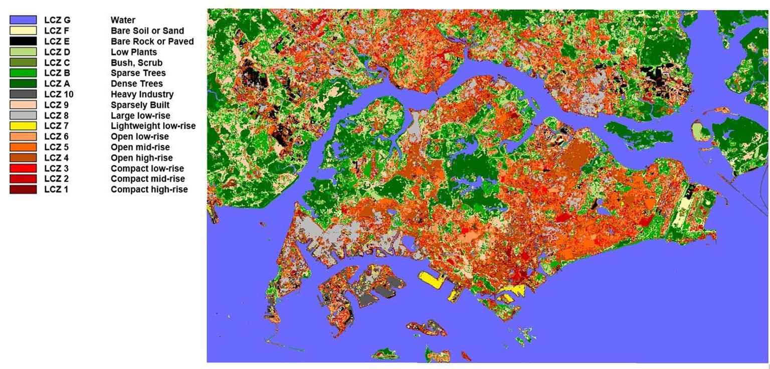
Almost a third of Singapore's land sits below the 5-metre contour, according to publicly cited government figures. That includes the reclaimed coastal apron of the East Coast, much of the Kallang Basin, parts of Jurong, and the low-lying valleys around Bukit Timah.
Four climate trends property buyers should track
- Rising sea levels: Mean sea level projections range from roughly 0.23 metres (low emissions) to 1.15 metres (high emissions) by 2100, per the V3 study. Higher seas mean higher baseline water levels when storms hit.
- More intense rainfall: The V3 study projects heavier short-duration downpours — the kind that overwhelm drains in under an hour.
- Hotter days and nights: 2016 and 2019 remain tied as Singapore's hottest years on record, and urban heat is itself a property consideration — homes in shaded, breezy locations increasingly command attention.
- Longer dry spells: Drought affects water security, landscaping costs, and even the structural stress on buildings over time.
None of these trends alone will "crash" the property market. But together, they are quietly repricing a very old asset class: land.
Projected Mean Sea-Level Rise by 2100 (metres)
The gap between the low and high scenarios — nearly a full metre — represents one of the largest uncertainties in Singapore's long-term property outlook. Coastal districts that appear identical today could face very different futures depending on how quickly the ice sheets respond.
Which Districts Carry the Highest Weather Exposure?
Not all flood risk is created equal. In Singapore, "flood-prone area" is a technical term with a precise definition — land that PUB has identified as susceptible to flooding. It's important to understand that the flood-prone map has shrunk dramatically. According to PUB, flood-prone areas covered about 3,200 hectares in the 1970s; today that figure is around 28 hectares — a reduction of more than 99%.
Flood-Prone Areas in Singapore (hectares)
That's a remarkable engineering achievement. But it's also a statistical sleight of hand. The remaining 28 hectares are not spread evenly across the island — they cluster in specific localised pockets, and the risk of flash flooding extends far beyond the official flood-prone map. Any low-lying point downstream of a large catchment can flood during an extreme storm, even if it's not on PUB's list.
The districts where water and property meet
| Area / District | Why it's exposed | Notable recent incidents | What buyers should check |
|---|---|---|---|
| Bukit Timah / Dunearn (D10, D21) | Valley floor draining the hills; high run-off from mature trees and landed estates | Flash floods in 2010-2011 and again in April 2024 along Dunearn Road | Ground-floor vs elevated units; nearby drainage improvement works; landed property drainage |
| Orchard Road (D9) | Historic drainage bottleneck in a dense commercial catchment | The famous 16 June 2010 flood at Liat Towers and Lucky Plaza | Basement retail exposure; Stamford Canal upgrade status |
| Katong / Marine Parade / Siglap (D15) | Reclaimed, low-lying coastal land built on sand | Repeated surface flooding after intense storms; storm surge risk during monsoon | Platform levels of the development; distance from the shoreline; coastal protection plans |
| East Coast / Bedok (D15, D16) | Reclaimed land barely above sea level | Heavy-rain flooding in low-lying stretches near the coast | Reclamation-era foundations; condo basement carparks; long-term coastal defence schedule |
| Punggol / Pasir Ris (D17, D19) | Coastal and estuarine, with mangroves and rivers | Surges during the north-east monsoon | Newer BTO/private designs with raised platforms; distance to waterways |
| Geylang / Kallang (D14) | Low-lying basin beside Kallang River | Historical flooding before drainage upgrades | Drainage reserve lines on URA Master Plan; recent PUB works in the area |
The Bukit Timah paradox
The most interesting case is Bukit Timah. It's one of Singapore's most expensive residential districts — home to Good Class Bungalows, prestigious schools, and mature greenery. It also has one of the longest flood histories on the island, with major inundations recorded since the 1960s. So why haven't prices collapsed?
The answer reveals something important about how climate risk interacts with property values. Flood risk in Bukit Timah is event-based — it happens a few times a decade, under extreme rainfall, and engineers keep making it rarer. Meanwhile the district's structural advantages — centrality, schools, landed scarcity, prestige — are constant. Buyers weigh a rare, manageable risk against a daily benefit, and for most of them, the daily benefit wins.
But the market is not blind. Agents in the Bukit Timah catchment report that buyers now routinely ask about flood history, drainage, and platform levels before making offers. The risk hasn't repriced the district out of existence; it has become a negotiation tool — and a filter that shapes which specific homes within a good district trade at a premium or a discount.
Do Flood-Prone Areas Actually See Lower Property Prices?
This is the question underneath the whole debate. The honest answer: it depends on whether the risk is chronic or episodic — and on how recently the last flood happened.
What international evidence tells us
Research in flood-exposed property markets consistently finds a "flood discount" — but it decays over time. After Hurricane Sandy hit New York and New Jersey in 2012, studies found that homes that had actually flooded sold at a discount that persisted for years, while homes in flood zones that hadn't flooded also saw softer prices. The discount was largest immediately after the event and faded as memories receded — until the next storm refreshed them.
The pattern repeats after every major flood event, from Hurricane Harvey in Houston to the Brisbane floods in Australia. Homes that flood repeatedly get hit the hardest because the market updates its risk estimate with each new data point. A single freak event is "bad luck." Two floods in five years is "a pattern."
What the Singapore evidence shows
Singapore has a thinner public trail of transaction-level flood analysis. There is no statutory requirement for sellers to declare that a property has flooded, and resale databases don't tag transactions with weather history. That makes it hard to point to a number and say "flood-prone homes discount by X percent."
What we do see is indirect evidence:
- Awareness is rising. Search interest in flood-related property queries spikes after every major incident. The January and April 2024 flash floods sent first-time buyers in affected areas back to the drawing board.
- Due diligence has become standard. Buyers, particularly in the resale and landed segments, now ask agents directly about drainage, prior flooding, and insurance before making offers.
- Insurance tells the story. Standard home insurance policies in Singapore may exclude flood damage or cap it at low limits. After the 2010 floods, insurers reassessed their exposure; today, buyers of ground-floor or basement-adjacent units increasingly discover that flood cover either costs more or isn't available. A property that can't be fully insured carries hidden risk that tends to surface at the negotiation table.
- Ground-floor units are the canary. In condos where basement carparks or ground-floor units have flooded, resale listings in those units tend to linger longer and attract lower offers than identical units on higher floors in the same development. The building's reputation moves faster than its price.
The "stigma" effect and why it fades
Flood stigma follows a predictable curve. Right after an incident, listing views drop, open-house turnout falls, and buyers push for discounts. Within six to twelve months, if there's been no repeat event, the market settles back — but not quite to the pre-flood baseline. Each repeat event re-anchors the discount deeper.
This matters if you're buying a home, not just an investment. Your neighbouring buyers may forget the flood by next year, but your insurance premium won't. And the next extreme weather event — not if, but when — will bring the question roaring back.
What this means for district-level pricing
In a market as tight and liquid as Singapore's, climate risk rarely produces visible district-wide price collapses. Instead, it works at the margins:
- Within a district, it differentiates specific streets, specific developments, and specific floors.
- Between districts, it reinforces already-existing preferences — coastal living in the East, for example, still commands a lifestyle premium even as coastal protection studies drag on.
- Over time, it will compound. A district that floods in 2025, 2035, and 2045 will look very different in the resale data from one that never floods — even if both look identical today.
This is precisely why Hiva's data on past weather incidents matters. It lets buyers look at where flooding has actually happened, not just where PUB's official map says risk is concentrated. Combined with transaction data, it turns "I heard this area floods" into a checkable, spatial fact.
The Government's Multi-Billion-Dollar Response (and What It Means for Prices)
Before you panic about sea levels, it's worth understanding how aggressively Singapore is engineering its way out of this problem — because government spending on climate resilience is itself a property price factor.
Drainage: the first line of defence
PUB has spent heavily to expand Singapore's drainage network since the 2010 Orchard Road wake-up call. In 2013, it announced a S$1.8 billion, ten-year programme to widen and deepen the country's drains. In May 2023, PUB announced another S$1.4 billion for the next generation of drainage works, targeting areas where rainfall intensity is projected to rise fastest. The Wong family of the Bukit Timah Canal and the enlarged Stamford Canal at Orchard Road are direct results of this spending.
The measurable outcome: flood-prone areas fell from about 3,200 hectares in the 1970s to roughly 28 hectares today. Fully 99% of the island's historical flood footprint has been reclaimed — an achievement almost no other tropical city can match.
Coastal protection: the long-term bet
Sea-level rise is a different beast because it never goes away. The Government has signalled this is a generational, multi-decade project. Reported plans include:
- A S$5 billion Coastal and Flood Protection Fund, set up at Budget 2020, to bankroll studies and early works.
- City-East Coast protection plans unveiled in 2021, covering about 30 kilometres of coastline from Marina East to Changi — with approaches ranging from earth dikes to polders and raised land.
- A parallel study for the North-West Coast, covering roughly 24 kilometres.
- A long-run price tag that could exceed S$100 billion over a century, as flagged in 2019 by then-Prime Minister Lee Hsien Loong.
What this means for property buyers
The good news: Singapore is not leaving coastal districts to fend for themselves. The bad news: coastal protection works take decades, and during that time, construction activity, access changes, and design constraints could affect the lived experience of nearby properties.
- Price support: Districts with committed government infrastructure tend to hold value better than districts where risk is acknowledged but unaddressed. The City-East Coast plan, whatever final form it takes, effectively puts a floor under long-term confidence in Marine Parade, Katong, and Bedok.
- Construction disruption: Coastal protection works along the East Coast will eventually involve visible engineering — dikes, polders, possibly raised parkland. Some sea views will change; some access routes will shift. Buyers near the coast should ask what planned works exist and factor in a decade or two of potential disruption.
- Rising building standards: New developments are increasingly designed for the future climate. Under the Singapore Green Building Masterplan, the target is for 80% of new buildings to be "Super Low Energy" by 2030, and HDB has been building flood-resilient designs — raised platforms, elevated common areas — into newer coastal projects. Buildings from the 1990s won't have these features; their long-term insurance and maintenance costs may diverge from newer stock.
The bottom line on government response
Flood resilience is now part of Singapore's urban planning DNA in a way it simply wasn't before 2010. For property owners, that's a stabilising force. But remember: government money protects the country; it doesn't automatically protect your specific unit. A raised dike on the coastline doesn't help a ground-floor flat in a valley that floods because its local drains are undersized. District-level resilience is only the starting point for due diligence.
A Buyer's Checklist for Weather-Resilient Property
Whether you're buying a BTO flat, a resale HDB, a condo, or a landed home, climate risk deserves a place in your checklist. Here's a practical framework.
1. Check the official data first
Start with PUB's flood-prone area information and flood alert history, which you can track through the myENV app and PUB's public advisories. Then overlay that with transaction-level data — Hiva's records of past weather incidents help identify which specific zones have actually been hit, which is more useful than a broad map. Finally, open the URA Master Plan and look for drainage reserve lines — land set aside for canals and water infrastructure. A unit near a drainage reserve faces both flood risk and future construction noise.
2. Read the topography, not just the address
Two units 500 metres apart can have very different flood exposure. Questions to ask:
- Is the development on elevated ground or in a valley?
- Is the entrance ramp down to the basement carpark lower than the surrounding road?
- Does the estate sit behind a canal or retention pond that handles stormwater?
3. Ask the management about past incidents
If you're buying a condo, request the minutes from recent council meetings. Ask directly: "Has the basement carpark ever flooded? Have lifts or electrical rooms ever been water-damaged?" In HDB resale, check with the branch office or look for records of past localised flooding in the estate. Owners who've dealt with a flooded carpark rarely forget it — and the information is usually available if you ask the right people.
4. Read the insurance policy before you sign
Find out whether your intended home can be insured against flood damage, and at what premium. If flood is excluded, treat that as a real carrying cost of the property. A S$10,000 repair bill after a freak storm is survivable; a S$200,000 interior renovation loss is not.
5. Prefer elevated units in exposed areas
In any flood-prone pocket, the highest-floor units are structurally safer. That sounds obvious, but it's easy to overlook when you fall in love with a garden-level unit in a good development. In Katong or Bukit Timah, the rule is simple: buy up, not down.
6. Factor in the government's plans
Check whether the area is covered by announced coastal protection or drainage works. Being inside a planned protection zone is generally good for long-term value — but it may come with years of construction. Being outside a protection zone in an unprotected coastal area is a very different risk profile.
7. Think in decades, not seasons
A 99-year lease outlasts many climate cycles. If you're buying in your 30s and holding until retirement, you're buying into a period when Singapore will very likely be hotter, wetter, and higher-sea-leveled than today. Ask whether the asset you're buying was designed for that world or inherited from an older one.
8. Use climate risk as leverage, ethically
If an area has genuine flood history, that's a legitimate factor in negotiations — but take care not to overstate it. Sellers and agents have legal duties around misrepresentation, and buyers who raise flood concerns based on documented incidents are on much firmer ground than those trading in rumours.
Food for Thought
- Would you buy a "discounted" flood-prone unit if the discount were real but invisible in the data? Most Singapore buyers can't tell how much climate risk is already priced into a listing. How would you know if you're getting a bargain or a trap?
- Should Singapore mandate flood disclosure for all property transactions? A simple declaration — "this property has/has not experienced flooding" — would transform the resale market's information gap. Would it also unfairly depress prices in areas that have since been protected?
- What happens to coastal districts in 2060? The City-East Coast protection plan is designed to be adaptable over the next century. But if you buy a 99-year leasehold condo in Marine Parade today, your lease ends around the time the highest sea-level scenarios arrive. How should lease length interact with climate horizon?
- Is "climate premium" the next "MRT premium"? Singapore's market already pays a premium for walking distance to an MRT station. As extreme weather becomes more visible, will buyers pay a measurable premium for high-ground, flood-free, well-drained developments?
- How should buyers weigh a rare but catastrophic risk? A 1-in-100-year flood is a low-probability, high-impact event. The rational buyer discounts it; the risk-averse buyer doesn't. Which one are you — and does your answer change when you're buying with a 30-year mortgage?